PE Catalog Navigator
The Catalog Navigator can be opened from the Catalogs button in the PE Main Toolbar, or from the Catalog Menu in the PE Main Menu.

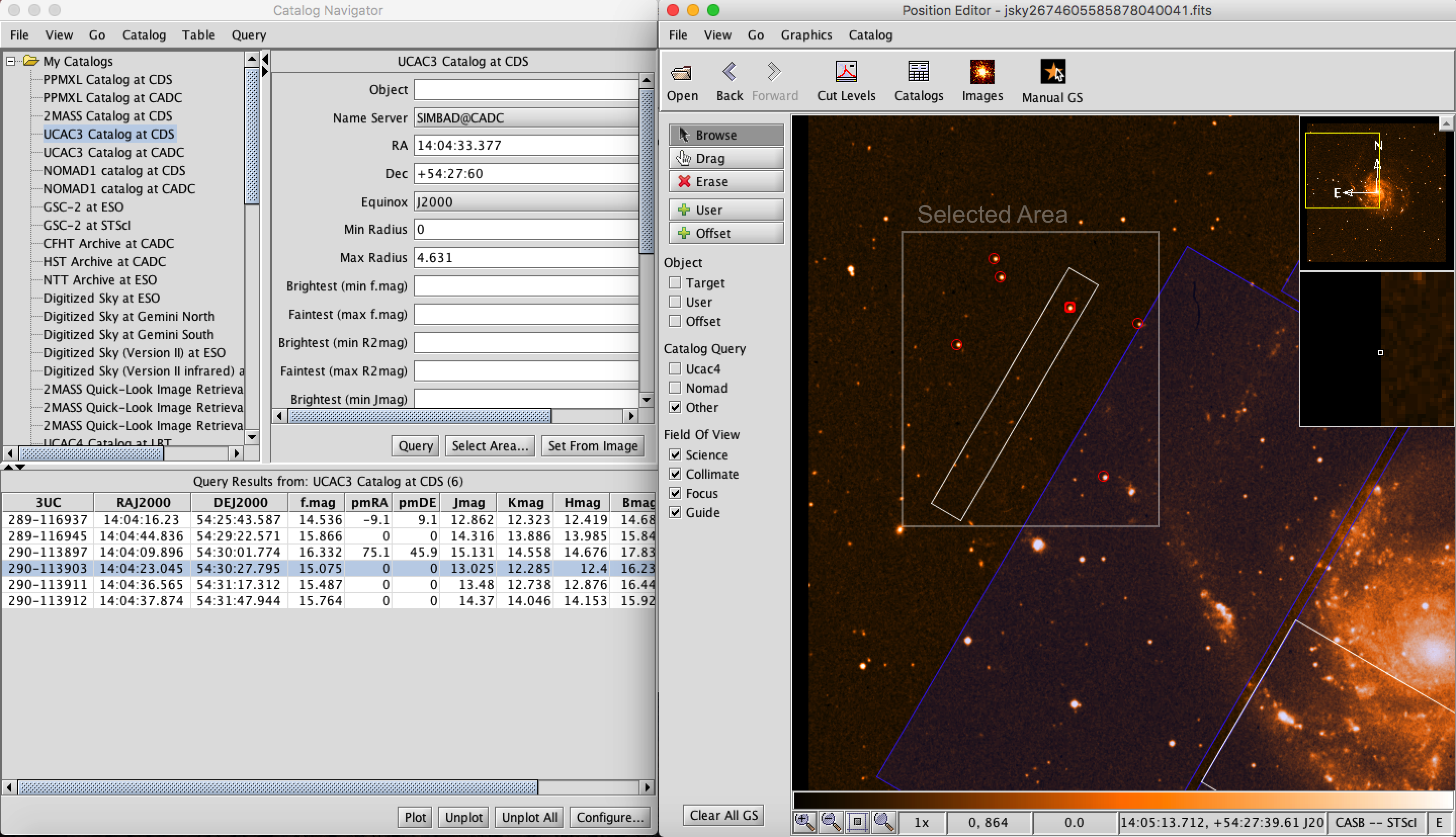
A number of data centers with object catalogs and image servers can be queried remotely. The catalog navigator can be used to download an image of the field around the science target, plus the co-ordinates and other properties of objects within this field from these object catalogs and image servers. This is particularly useful when laying out the telescope offset pattern and when selecting guide stars. These object catalogs and image servers are listed in the Catalog section of the catalog navigator.
One can select an area for query from the catalog by selecting the button. A pop-up will appear and ask the user to drag an area from the Position Editor Viewer with the left mouse click. The RA and DEC of the catalog query populate with the center of the selected area and the selected catalog will be queried for the selected area.
If the button is selected the RA DEC will be populated with the central coordinates of the image (target coordinates in most cases) and the catalog will be queried for the entire image space. This is the default if neither the Select Area nor Set from Image Button are selected.

The Query Results are listed in the lower panel. Selecting a catalog star in the Query Results Table will bold that particular target in the position editor viewer. Selecting a catalog star in the position editor viewer will highlight this item in the Query Results Table.
The plotting of the Query Results in the Position editor Viewer can be cleared using the Plot Control and Configuration Buttons at the bottom of the Catalog Navigator.
A user can also upload their own images and catalogs using the Catalog Navigator Main Menu.